

It’s amazing how far we’ve come with satellite navigation in the last 40 years. GPS (Global Positioning System) is one of the most useful things to have ever come out of modern technology, and it’s now built into every mobile phone and standard equipment on almost every car.
However, in the early days of automobiles, getting from point A to point B proved a bit tricky. Roads were in their infancy, highways were decades removed from what they are today, and they had primitive road signs where anyone could get lost.
It didn’t take cartographers long to see the need for maps in vehicles, and what started with folded maps shoved into the glove compartment has grown into a multi-billion dollar industry.
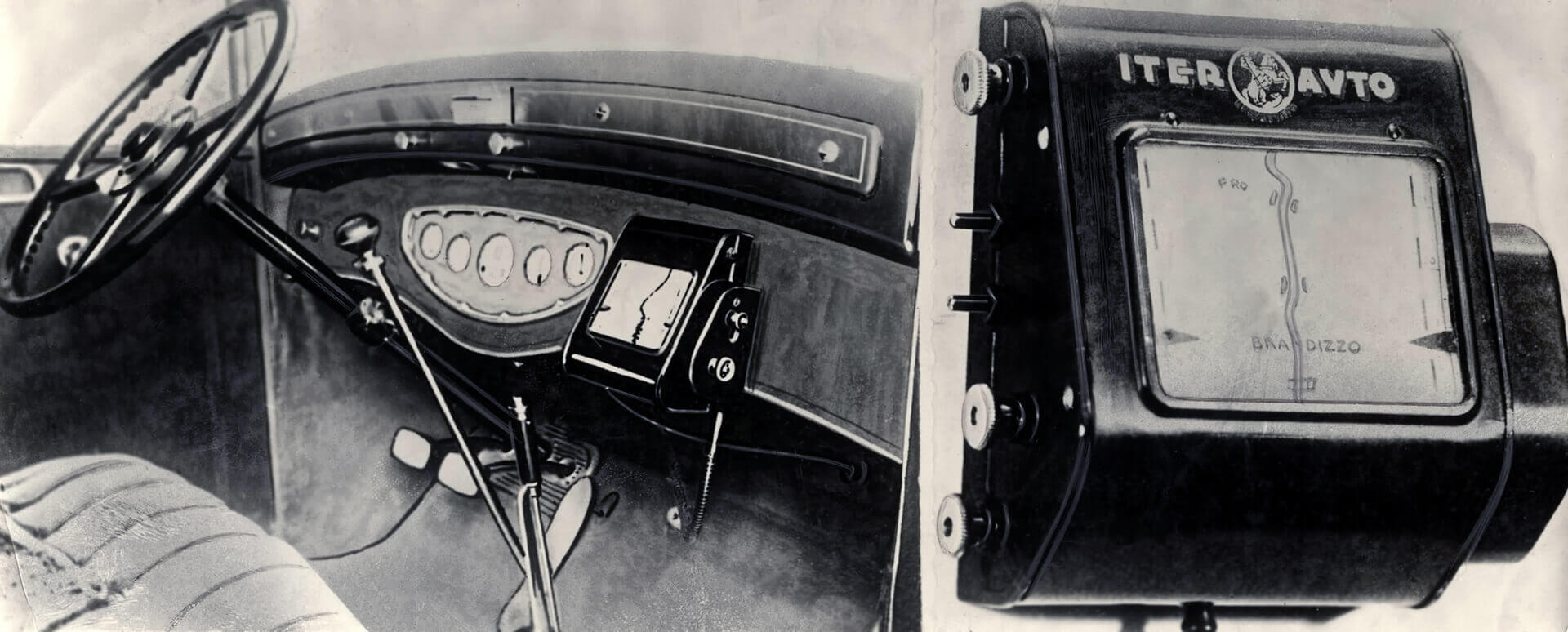
But it all started with Iter Avto.
Designed and created in the 1930s, it is more like a “map guidance instrument” since it did not actually give voice instructions and directions and, of course, did not use satellites.
Avto Route of 1930
The device came with a set of paper maps. These were rolled up on a display, and a cable connected to the speedometer controlled the scrolling speed. The speed at which the display moved was proportional to the car’s speed, so it always showed the correct location. The big problem was that whenever you strayed from your route, you had to load a new map and find your exact current location.
The first true automotive navigation system was developed nearly forty years ago by Honda, Alpine, and Stanley Electric and was called the Electro Gyro-Cator.
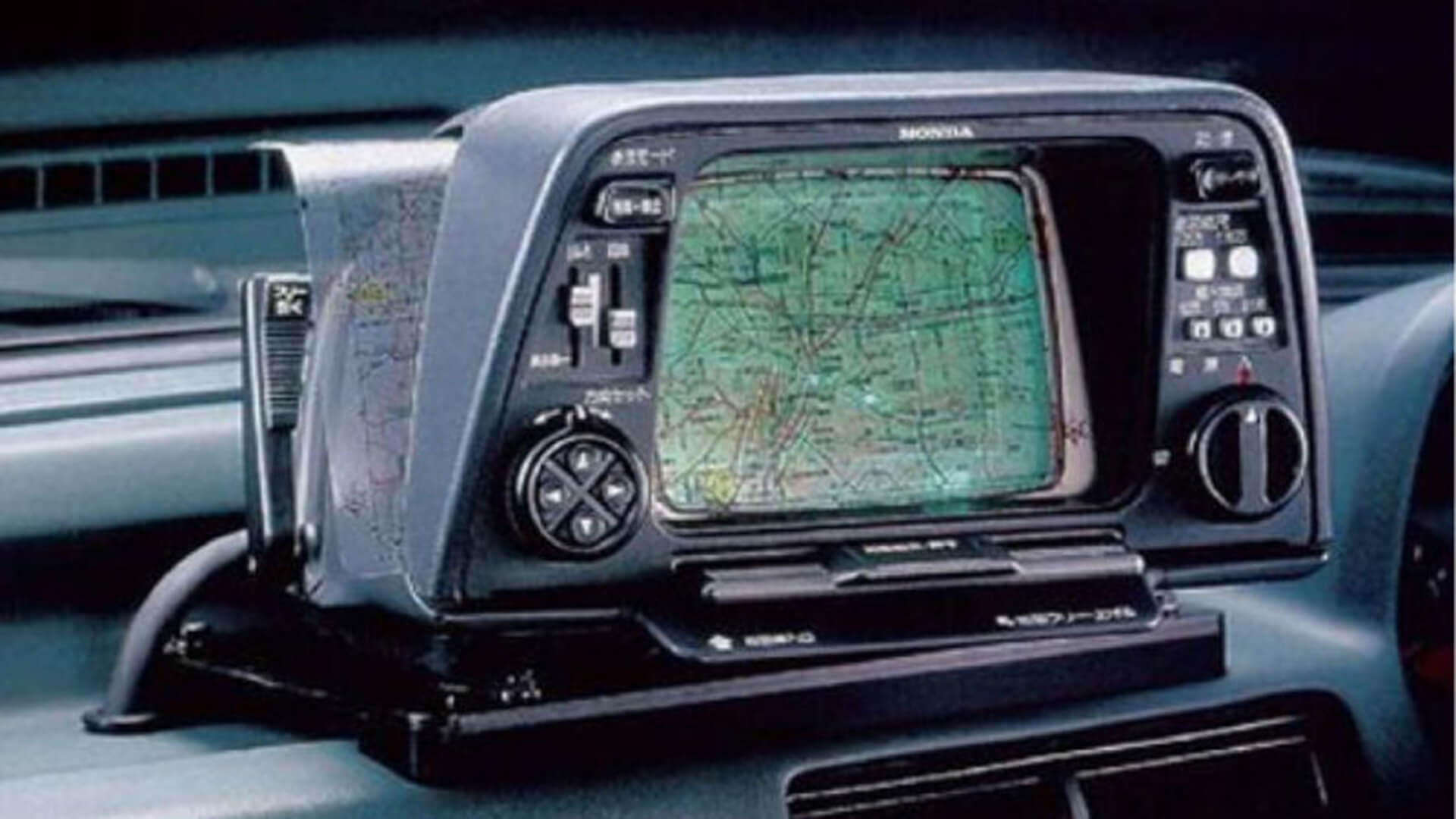
1981 Honda with Electro Gyro-Cator navigation unit
Introduced in Japan in 1981, this “inertial navigation system” used a small helium gas gyroscope and was more similar to systems used by fighter pilots during the Cold War.
Inertial navigation systems are based on a fairly simple principle: if you know where you started, how far you’ve traveled, and which direction you were going, then it shouldn’t be difficult to figure out where you are. Apply that concept consistently, and you’ve got a basic navigation system in place.
The translucent maps had to be manually positioned on the screen and scrolled across a 6-inch monochrome display used for illumination and location purposes. The unit was optional and cost about $2,750, nearly 25 percent of the price of cars at the time.
The first transition from paper maps to digital maps stored on portable media was with an aftermarket system called Etak in 1985.
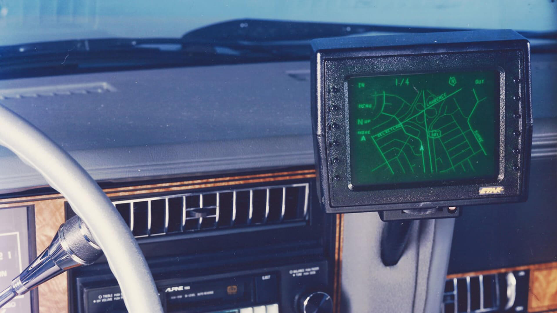
It read map data stored on a cassette tape drive, and each tape covered a section of a city. Navigating Los Angeles required four tapes, and if you left the cassettes in the car on a particularly hot day, you wouldn’t have much luck reaching your next destination.
Etak included a monochrome screen that moved as the car moved. The system was technologically advanced for its time and, naturally, quite expensive, but Etak managed to sell several thousand units over several years.
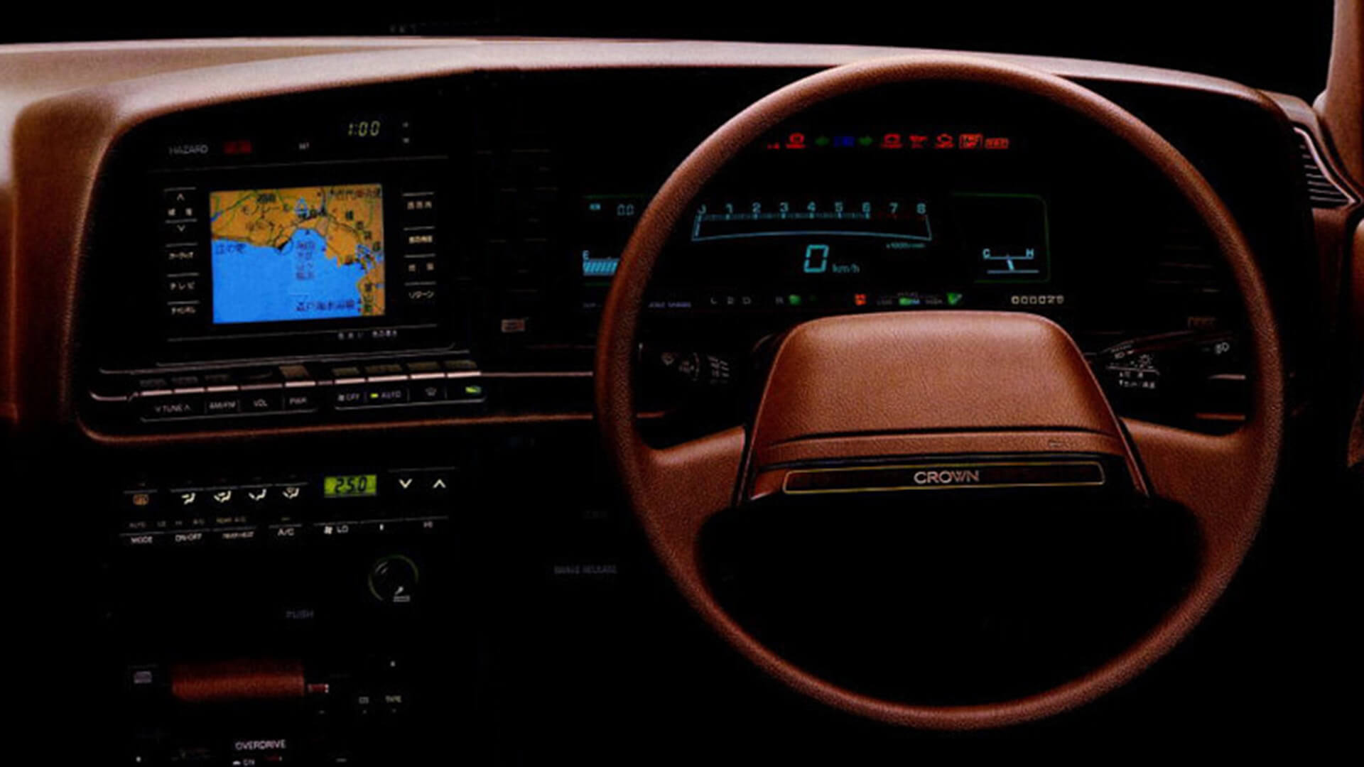
In 1987, Japan brought two lesser-known but important advances in navigation technology to the automotive world. The Japan-only Toyota Crown Royal Saloon G was the first with a fully-mapped in-dash CD-ROM navigation system and the first with a color display.
In 1990, Mazda introduced the first-ever GPS system for automotive navigation. Offered in the top-of-the-line Eunos Cosmos cars and available only in gadget-loving Japan,
Mazda’s navigation system was integrated into the actual car. For the first time, your position on the road could be triangulated in real time by satellites in space. Truly, the “space age” had finally arrived in the automobile.
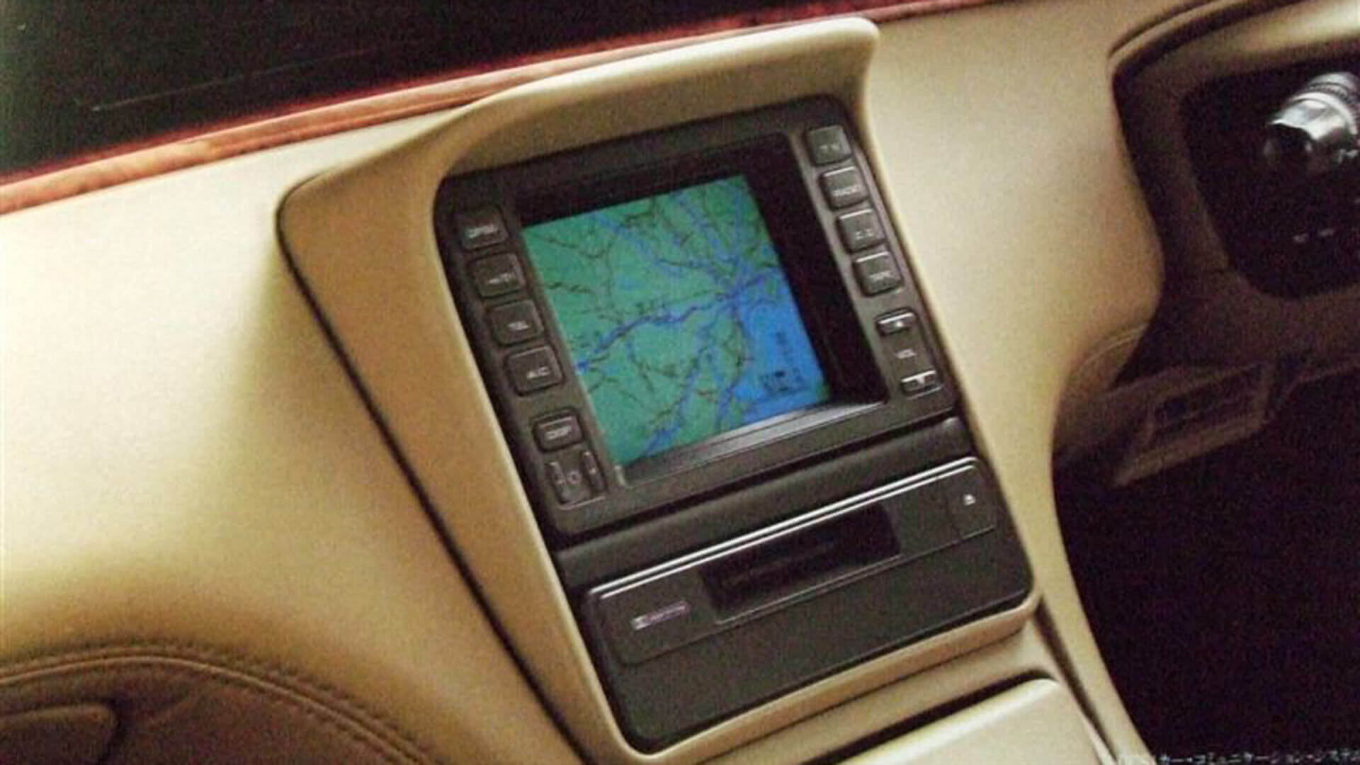
Meanwhile, General Motors had developed an ONIS integrated GPS navigation system, initially introduced in 1992 on Avis Rent A Car vehicles in Florida. The system was officially added to Oldsmobile’s 88 series as a factory option for the 1995 model year.
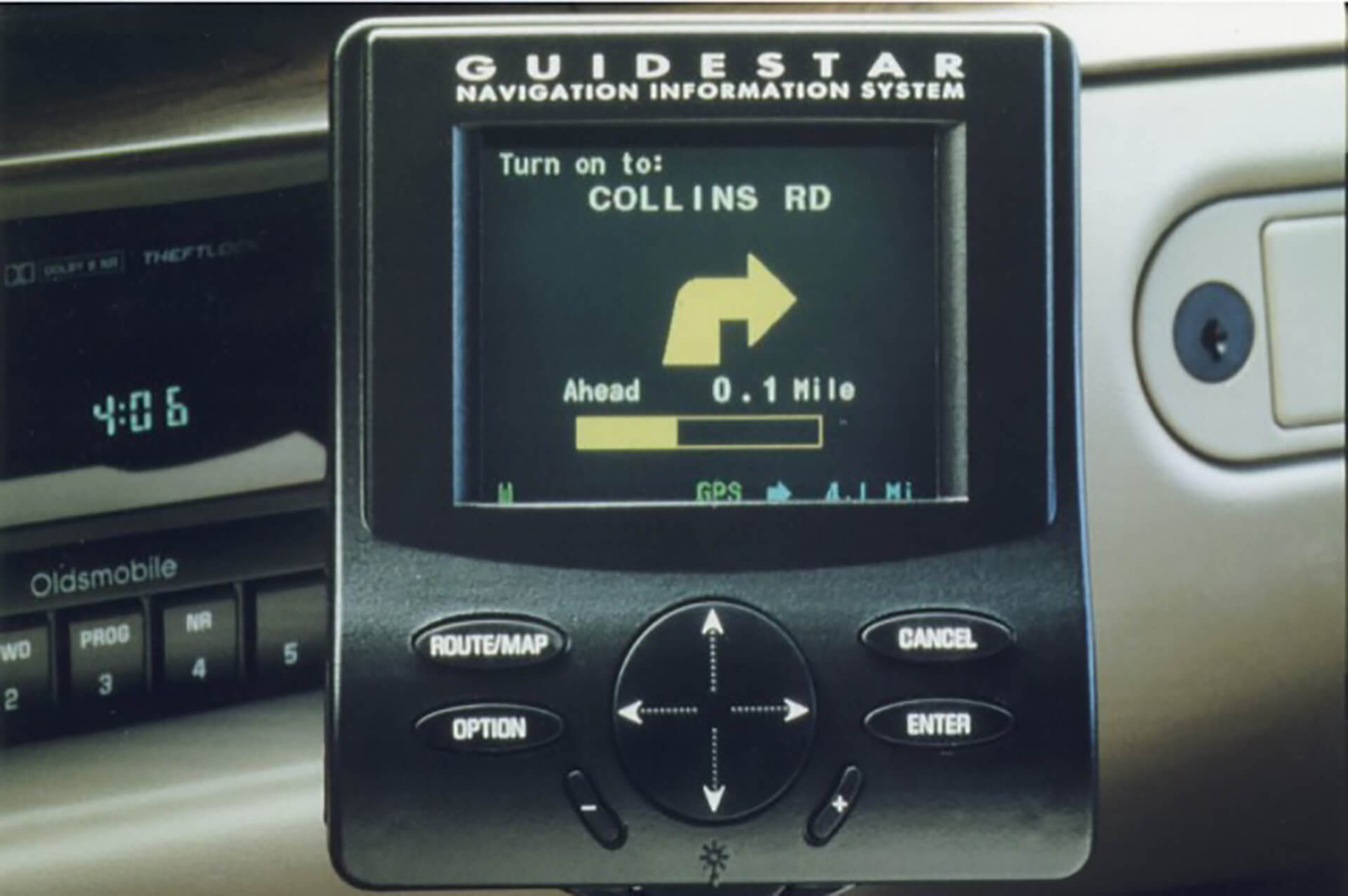
For retail, it was renamed GuideStar. Initially, only California and Las Vegas were mapped, but soon other mapping “cartridges” covering a wider area became available.
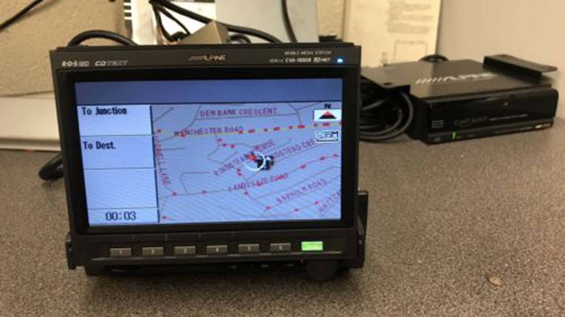
In 1997, the Japanese company Alpine introduced its own version of a pop-out CD-ROM (map-ready) navigation system that used GPS (Global Positioning System) satellites. Each CD containing mapping data covered only a few states. However, this system would allow for retrofitting, and any car buyer could add GPS to their vehicle.
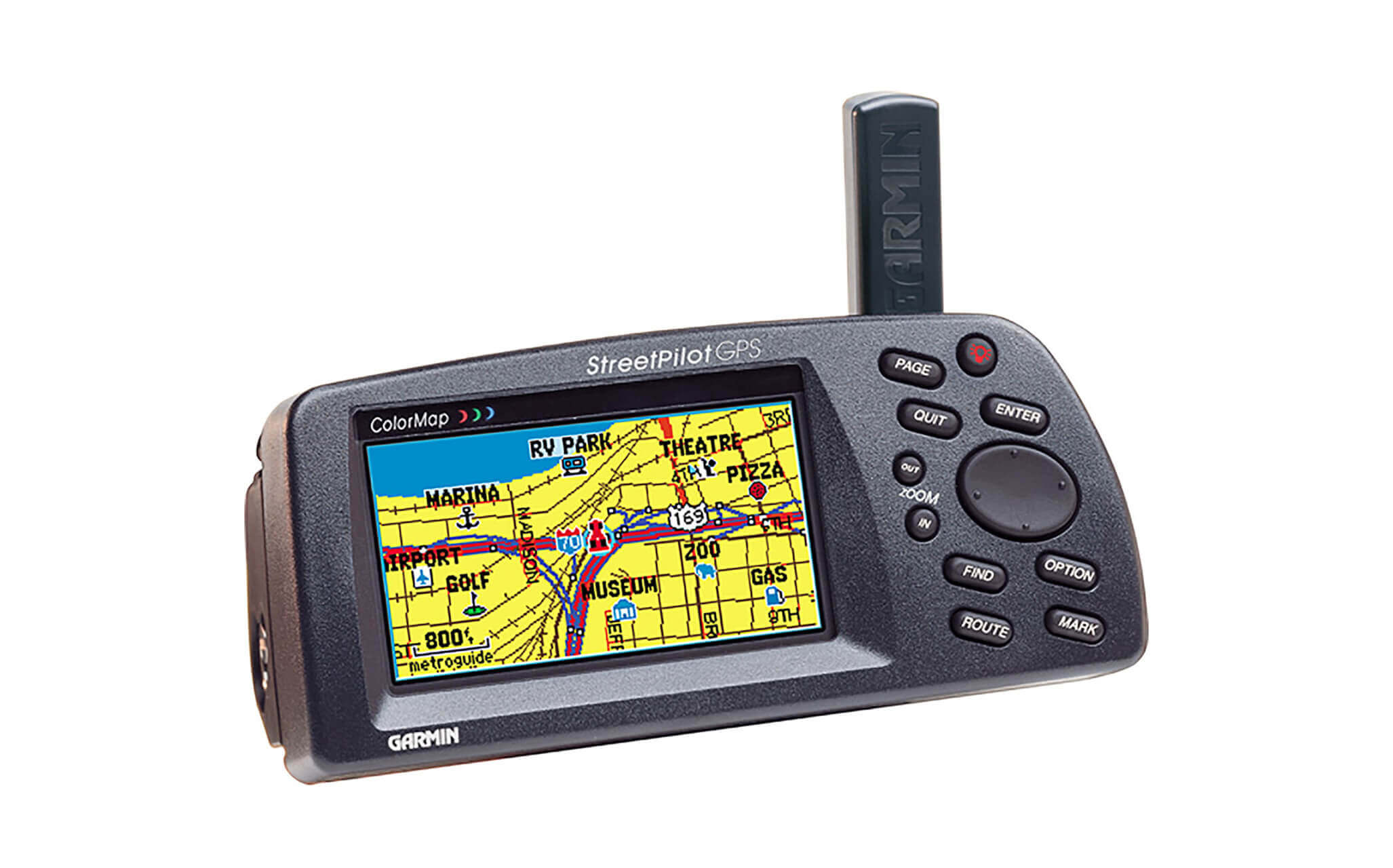
In 1998, Garmin introduced its first portable GPS navigation system, the StreetPilot, for automotive use. It had a black-and-white display and used mapping cartridges. A single cartridge could cover an area as small as Atlanta.
This was a huge advance, because now anyone could buy a GPS navigation system if they could afford it. The initial list price was around $550. Best of all, it could be moved from car to car at will. Because the U.S. government deliberately limited GPS functionality, it wasn’t until 2000 that full-featured GPS technology was installed in commercial vehicles, with new luxury vehicles like the BMW 7 Series claiming this technology.
Since then, GPS technology has advanced by leaps and bounds, with many drivers now relying on smartphones for traffic and directions.

Automobiles have come a long way in the last quarter century. Indeed, the advent of GPS technology has been a major turning point in the way people travel today. Arguably, as we’ll see in a future article, the safety of these technologies is still in need of further improvement.
Follow us on Google News to receive daily updates on cybersecurity. Contact us if you would like to report news, insights or content for publication.